Photo Credit
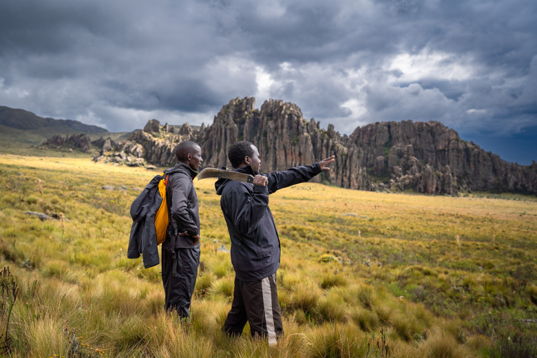
"Howl a few times like a hyena when we have some distance between us and an elephant, and we'll try to reconvene in that valley below," Martin wheezed out as we thrashed our way up the bamboo-strewn undergrowth. We had put as many contingency plans in place as possible, but somehow left out our strategy for signaling to each other when we inevitably got separated in an animal encounter—which seemed likely looking at the elephant herd amassing in the distance. "I guess that works..." I muttered between labored breaths, hoping I could recall what a hyena sounded like with an angry grey giant on our heels. We had seen countless elephants on our trek across the Aberdare National Park in Kenya, East Africa—but this was the first time it seemed confrontation may be unavoidable. The dense brush choked in tight around us but offered little comfort this close to the country's largest wild animal. As one of the elephants slowly lumbered toward us, ears flapping in disapproval, my two trekking partners silently split and beelined for the valley. I backtracked a bit behind a small rise and carefully picked my way through the thicket, hardly daring to breathe. I suddenly felt very alone and vulnerable. This was no casual stroll on the Appalachian Trail.
Editor's note: This is not currently an open trail, and you cannot trek in the Aberdare National Park without approval from Kenya Wildlife Service and an armed guard.
The Aberdare National Park was a staple of my childhood. I have endless fond memories of wading through dense mazes of bamboo, running from rogue cape buffalo, and gawking at immeasurably massive waterfalls—but I always knew there was more potential. The idea for a long-distance trail across this unique ecosystem had been in the back of my mind for decades, but wasn't spoken out loud until 2021. I had been invited to help develop some climbing areas in the northern sector of the park, and shoot a promotional film for Kenya Wildlife Service (KWS) and a lodge named Cedar Retreat near Shamata. During my time in Kenya, I connected with some fellow backpackers and began plotting a remote trek across this magical park. The idea of having an established backpacking trail that crosses the Aberdares from north to south is not new, but the logistics of such a route are quite complex.
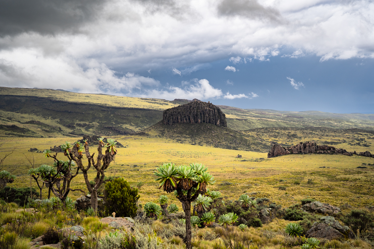
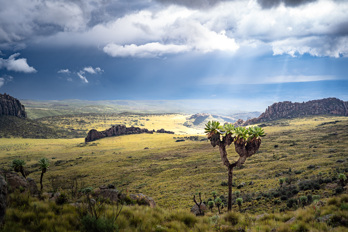
For one, the sprawling park is stippled with rugged mountains, oscillating between 10 and 13,000 feet high, and the Aberdares serve as one of Kenya's primary water towers—meaning it's frequently drenched in rain. Swampy, spongy moorlands decorate the highlands, absorbing rain and fog and funneling it to the range's massive rivers and waterfalls. It's a magical, important ecosystem—but an absolute bear to navigate. On top of that, it's home to a plethora of elephants, waterbuck, cape buffalo, the endangered Mountain Bongo and Black (Melanistic) Leopard, hyenas, and countless other wild animals—and unfortunately, a hotspot for poaching. The remote, rugged nature of the park makes it more difficult for KWS to monitor hunting than other areas of Kenya, translating to an uptick in illegal activities. That said, it's one of the only parks in the country where guided trekking is allowed on short trails to stunning scenes like Oldoinyo Lesatima (13,127 ft), Mt. Kinangop (12,815 ft), and the towering Karuru Falls. These zones are separated by massive swaths of gorgeous montane forest, bamboo groves, and alpine moorland, and offer incredible trekking potential—but no trail currently traverses the entire range. There are talks to change that, and the first step is mapping a potential route.
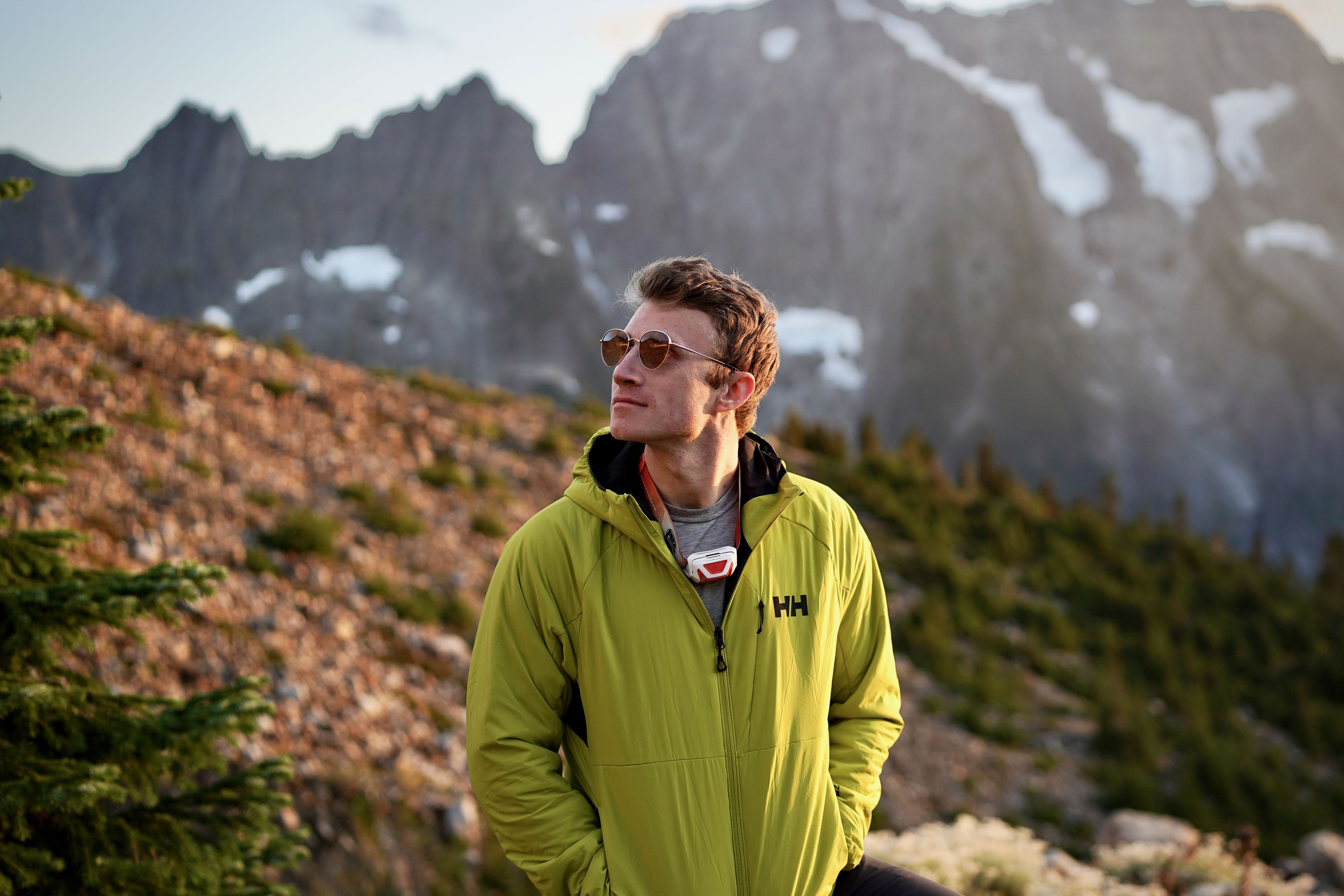
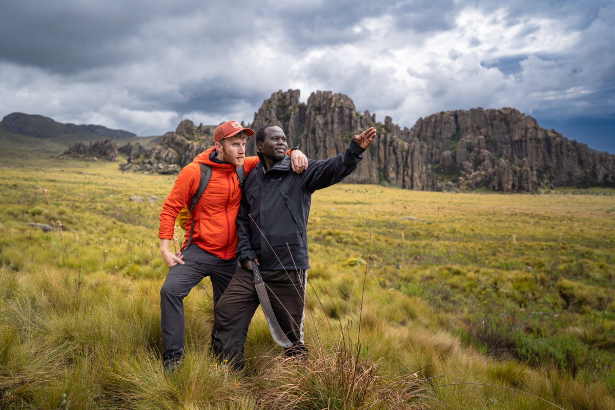
I returned to Kenya in January of 2024, hellbent on the idea of picking my way through the dense maze of bamboo, towering peaks, and gaping gorges dancing with rapids, from Shamata in the north to Njabini in the south near Mt. Kinangop and Elephant Hill. I estimated the route to be around 100 kilometers (62 mi.). After a week of meetings with KWS, wrangling up the requisite supplies, and pulling together a team, I traveled to Shamata on the 24th, aiming for a three to four-day trek in the bush. I connected with two locals who had accompanied me on many missions in the park over the years: Paul and Martin. Paul, a Kikuyu from a nearby village, and Martin, a Kalenjin from Laikipia, live at altitude, are incredibly fit, and are well-accustomed to the ruthless Aberdare terrain—but have minimal backpacking experience. It took a bit of convincing, but they finally agreed to join me.

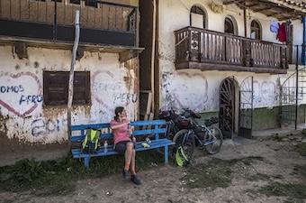
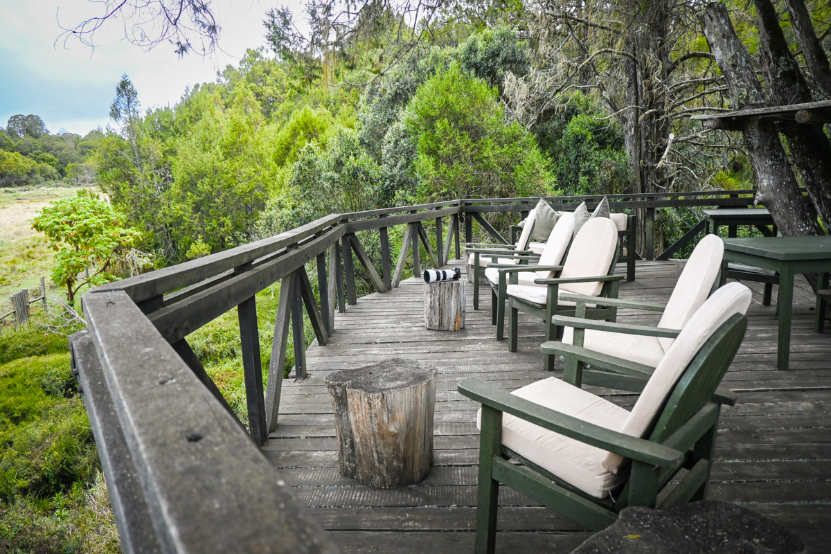
Any grand adventure needs a basecamp—and the quaint but luxe Cedar Retreat is the perfect pre-hike haven. Since my first project with owner Tarsem Sembi back in 2021, we’ve formed a close friendship, and I stay at his lodge whenever I can. It offers a uniquely peaceful escape for safari-goers from Nairobi and travelers seeking adventure in the northern sector of the park. Set within a lush cedar, hagenia, and podocarpus forest, the lodge is structured around an old salt lick clearing, which attracts elephants, zebra, and buffalo nearly every day. It's beautifully designed—and the perfect starting point for a long journey.
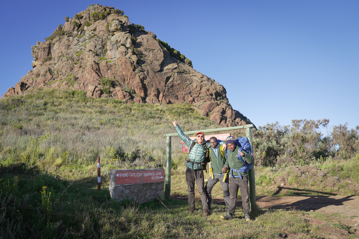
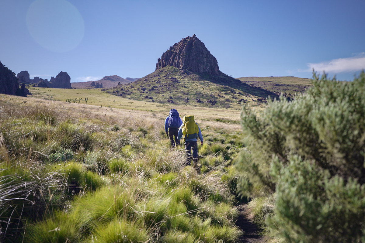
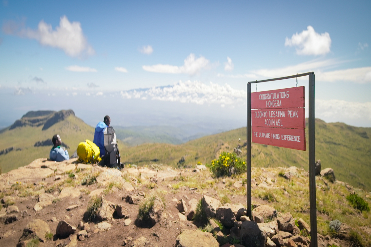
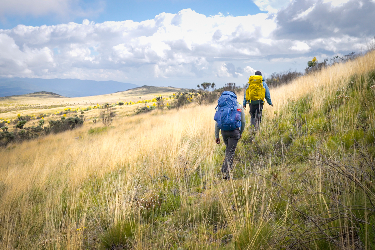
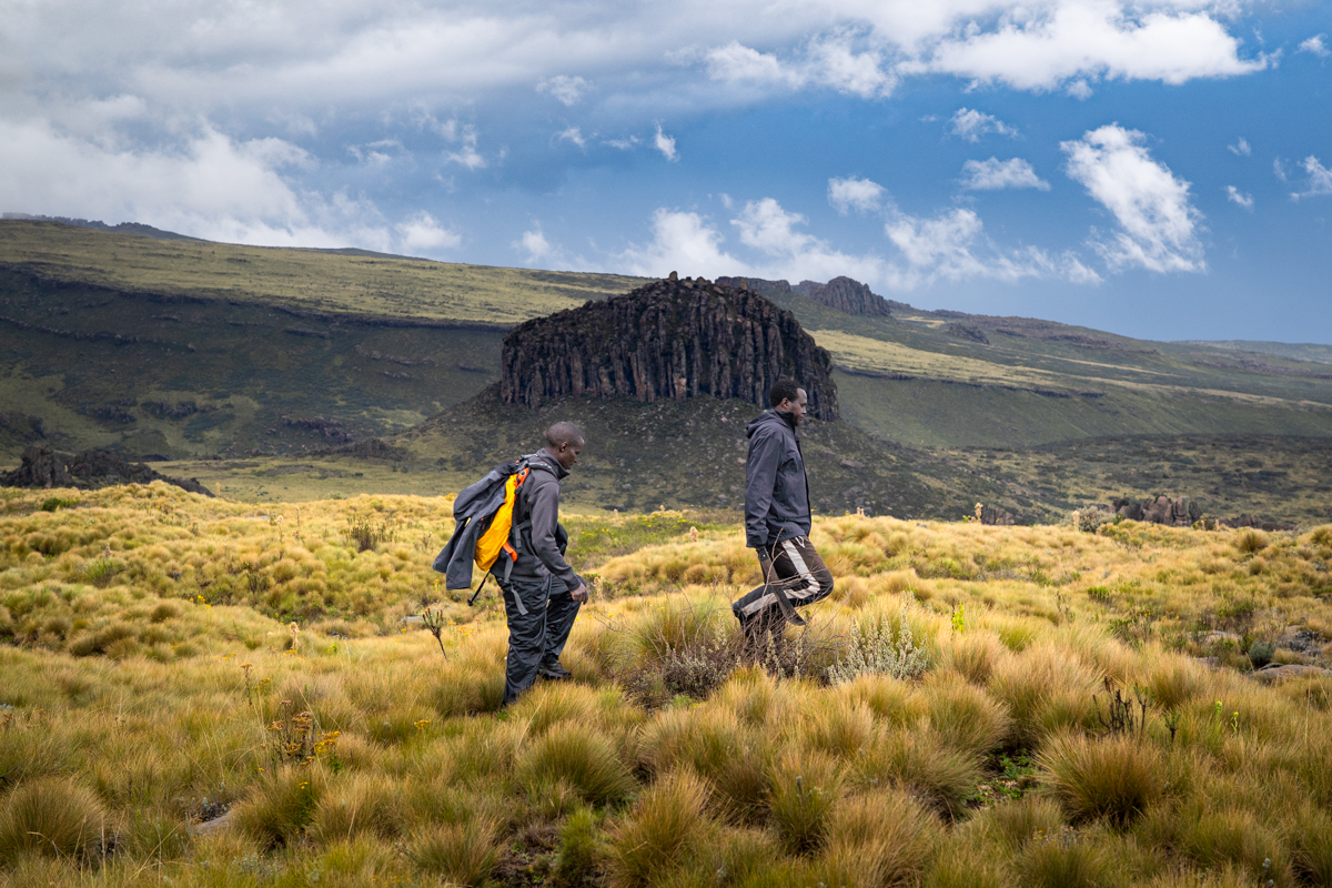
After a couple of days of organizing gear, teaching Paul and Martin about freeze-dried backpacking meals, poring over topo maps, and filling our bellies with ugali at Cedar Retreat, we set out early on the 27th. We packed enough food for four days, a full filmmaking kit, machetes, and bulky insulation for the cold nights ahead. This wasn't going to be an ultralight cruise on mellow singletrack (you can peruse our full, robust gear list below). A rough established trail runs for around four miles from a road south of Cedar Retreat up to Oldoinyo Lesatima (Mount Satima), the highest point in the park—and the third highest peak in Kenya—at 13,127 feet. My Tennessee lungs screamed in protest as I tried to keep up with Martin's pace. We ensured our packs all weighed the same, but my two partners clearly had the upper hand in terms of fitness. The length of our route was at the forefront of our minds, though, so we cranked as fast as possible.

Soon we approached a headliner of the Aberdare range: The Dragon's Teeth. An endless series of improbable formations slice through a sea of spongy moorland grass—sharp basalt and phonolite pillars stretching to the clouds. Mist clung to this Mordor-like landscape as we poked our way through the bog, hopping between clumps of grass to avoid the landmines of deep muddy pits. The Dragon's Teeth is a popular trekking and rock-climbing destination, famous for its towering spires. But the established "trail" is anything but easy. In the rainy season, it's more of a wade, as the vast plains leading up to the cliffs fill with mud and water—but even in the dry season, the going is tough. The path winds its way to and fro between the jagged peaks before hitting firm ground again and climbing steeply to the summit of Satima. I started to truly feel my pack's weight... and doubt crept in. This was on an established trail, and it already felt desperate—how much tougher would it get when the bushwhacking began?
"Come on mzungu!" Martin laughed back at me as we romped up the final push to Satima's summit. "You try running up to 4,000 meters after living near sea level!" I shot back. Both Martin and Paul were in good spirits, but I could tell we had taken the last pitch a bit too fast. We were all feeling it—and that was the easy part. We grabbed a quick snack near the summit sign and turned our eyes southward. We were high above the treeline allowing us to see a good chunk of our proposed route. It looked incredible. Viscous wind yanked at our clothes, and Mt. Kenya rose like a solitary sentinel far away, protruding through a blanket of clouds to the east. It was a special moment—true tension between beauty and fear as the reality of what we hoped to accomplish set in. From this point on we would be entirely on our own, with only a handful of bail points until Njabini, nearly 100 kilometers to the south. It was time to commit... or turn back.
We hoisted our packs and cruised along a firm ridgeline, the world unfurling in every direction with sweeping 360-degree views. The climb earlier had knocked the wind out of us, but this easy, downhill stretch breathed life back into our legs. We moved fast—nearly jogging at times—yipping into the wind like kids let loose, the sun blazing overhead. There was a real thrill in veering off the established trail, knowing from here on out the route was ours to invent. But the reprieve was short-lived. The climbing resumed, this time without the aid of a beaten path, and the dry ridgeline quickly deteriorated into a gauntlet of bogs and spongy earth. We snaked our way between stone-capped peaks, ducked into groves of flowering giant groundsels, and skirted wide patches of swampy moorland. Progress slowed to a crawl. Boots were soaked through, legs screamed, and spirits started to fray. By the time we dropped our packs below the final slog up to Rurimeria Summit—towering at 12,570 feet—we were beat. The plan was to reach the headwaters of the Sagana River before dark, but based on our current state, that began to feel like wishful thinking.
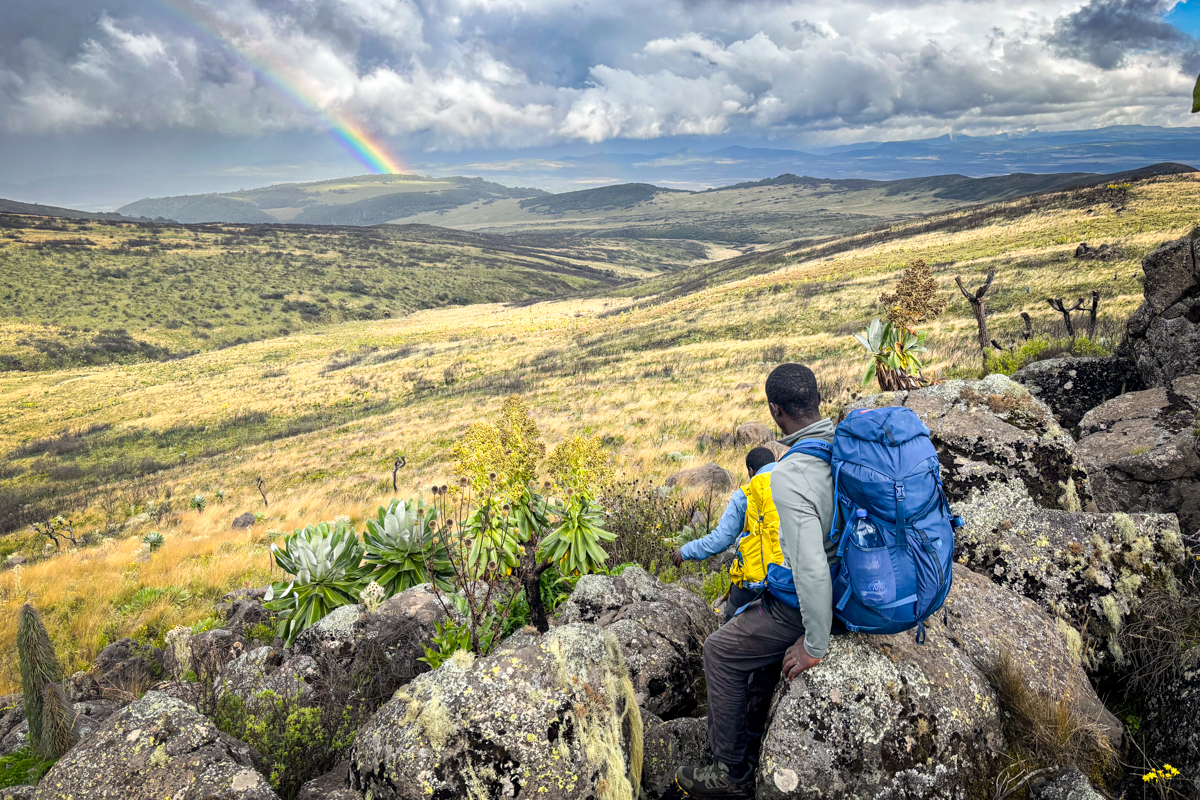
We took a breather, patched up some budding blisters on Paul's feet with Moleskin, and plunged back into the bush. It had been a bit of a rollercoaster up to this point—both in terrain and morale—but the rest of the day offered a gentler elevation profile. Up ahead was Mountain Gate, a striking natural “window” carved between two peaks that afforded us access to the western side of the range. Wind funneled through the gap with such force we had to shout to hear each other, but as soon as we stepped through, it was like flipping a silent switch. On the far side, the landscape opened into a wide, sunlit bowl of golden savanna grass and quirky-looking giant groundsels—calmer, quieter, and completely transformed. It was a peaceful scene—despite the small venomous Kenya Montane Viper that Martin nearly stepped on just as we crossed through the gate! A reminder to watch our step in the midst of the hustle.
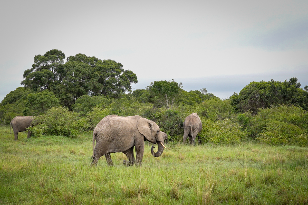
As we dropped elevation, signs of wildlife emerged around us. Elephant, common eland, and cape buffalo dung littered the ground, and before long, a massive herd of eland exploded from a nearby grove in a flurry of hooves and horns, galloping rapidly towards the ridge. The moment jolted us into alertness as the ground underfoot shook with the impact. There’s a strange duality to encountering African wildlife on foot—an uneasy concoction of awe and vulnerability. You’re fully exposed out here, no steel frame or engine to shield you—but that proximity also lets you tap into the wild, electric presence these animals give off. You just can’t feel that from the back seat of a Land Cruiser... but the fear of an intimate elephant encounter was at the forefront of our minds from the beginning of our trek.
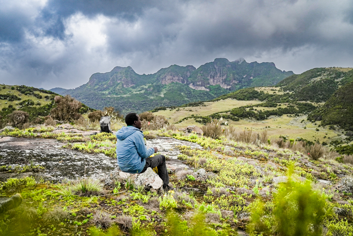
As we crested a small ridge beyond Mountain Gate, a panoramic view opened up with Mount Kinangop looming far to the south—one of our final climbs. The distance was daunting. “We’re going all the way there?!” Paul exclaimed, prompting a deep laugh from Martin. From our vantage, we could trace the zones ahead: soggy moorland, dense brush, and finally thick montane forest. It was clear this route would demand everything we had. But first, a sprawling marsh stood in our way. Hoping to skirt it, we scanned the topo map, but no detour looked promising given our time constraints. We had to go straight through. The ground dissolved into slimy muck stippled with islands of grass. I promptly lost my balance and toppled in, swallowed up to my waist by cold, gelatinous sludge. Paul reacted fast and hopped over to haul me out—and thankfully my boots came with me. What followed was a slow, nerve-wracking tiptoe across tufts of grass, each step a gamble. By the time we reached dry ground, our legs were caked in mud and our energy nearly spent. "Hide!" Martin suddenly whispered as he leaped behind a boulder.
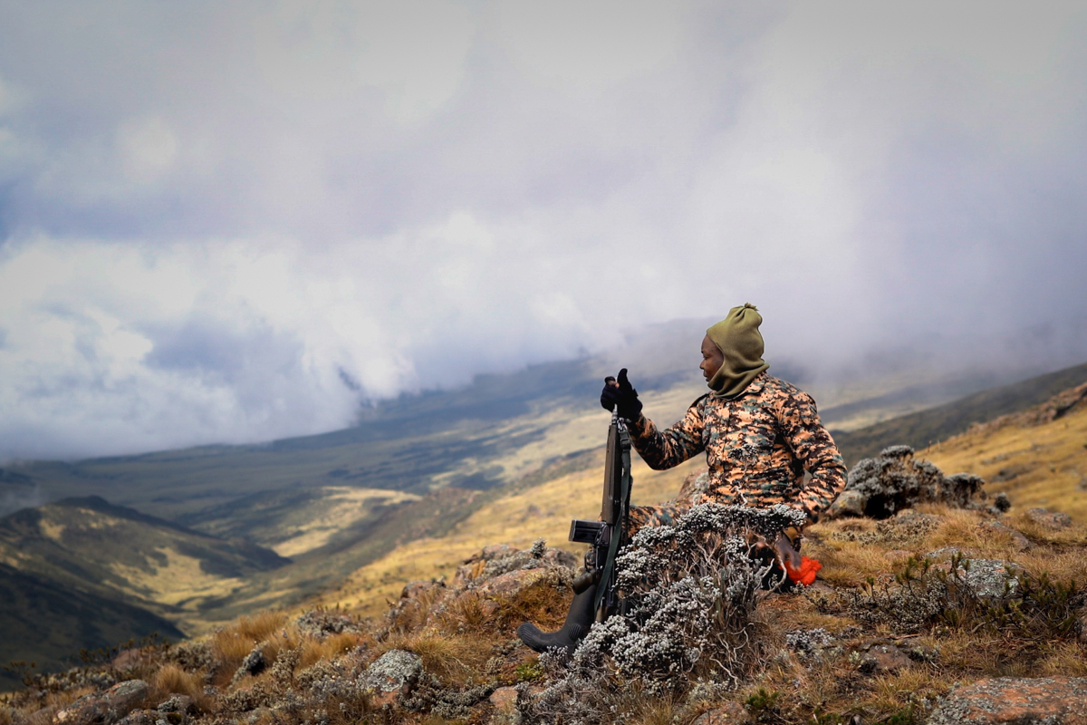
"What is it?" I called from behind a bush I’d scrambled to. "Wawindaji," Martin shot back, a finger to his mouth. Hunters. The remoteness of the Aberdares, and the lack of roads or trails in large swaths of the park, still make it a hotbed for poaching. KWS has strict laws against hunting or trapping, and getting caught can be dangerous. Poachers are often aggressive when surprised. I chucked our binos to Martin, and he peered around his boulder. "I spot at least seven with spears. Looks like they just killed a buffalo." Fear gave way to anger… and deep sadness. I knew poaching was a mounting issue, but seeing it in action hit hard. "Ticks me off," I muttered. "They’ll hopefully pass soon. Let’s stay hidden till they’re gone." We had no guard, no weapons—just machetes. Sitting ducks. After twenty tense minutes, we crept out from the rocks and scrambled lower down—only to run headfirst into the ramshackle group. For some reason, they’d circled back and were now directly in front of us. Seeing us, they froze—then bolted, dropping their bloody kill and spears just feet away. Luckily, they thought we were rangers. All seven scattered in different directions, shouting and whooping to disorient us. "Well, I don’t want them to find out we’re not armed!" I said, and we sprinted in the opposite direction, hearts pounding at the thought of them returning to snag their reward.
Adrenaline surged through me as we indiscriminately plunged into the thick bush leading down to the Sagana River. None of us seemed to feel pain as we thrashed through impenetrable branches, scratching our arms and tearing our clothes. We had a single-track mind: get as far away from these guys as possible. Thankfully, we began to reach stubby trees and thicker brush as we hit the bank of the Sagana, shielding our view from the poachers behind us. But we dared not stop until night, and tried our best to hide our tracks, crossing and even walking in the Sagana River when we had the chance. We caught occasional glimpses of the ridge the poachers ran to through the thicket, and could barely make out their long spears on the horizon, keeping watch over their kill. "You don't think they'll try to follow us?" I asked my companions. "Hopefully not," they mused. "Once they snag their buffalo, they'll try to get into thick forest before dark." We walked into the night, and once we felt sufficiently hidden, pitched a stealthy camp beneath a stunted hagenia tree.

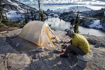
We passed the night with zero issues from animals (or poachers) to our great relief. All night, however, we heard the faint trumpeting of elephants far away, and even a group of cape buffalo romping around close by. My flimsy MSR Freelite tent offered little confidence against such giant fauna, but thankfully, they kept their distance. The morning sun broke clear and warm—always a welcome surprise in the notoriously rainy Aberdares—and we left camp quickly. We climbed out of the river thicket and onto open ridgeline terrain, where we hit our stride. The earth was hard-packed, temps were perfect, and sweeping views of Mount Kenya and Kinangop lifted our spirits. Before long, we reached the next stage of our trek: thick montane forest.
A break from the wind and exposure was welcome, but our pace plummeted as we dropped into thick, wet jungle. The soft yellow grass disappeared, replaced by thorny vines and dense bamboo tangled beneath a canopy of twisted hagenia and cedar. We rotated lead with the machete, each of us hacking a rough path through the undergrowth. Progress was grueling. As we pushed deeper into the valley, elephant signs became more frequent—broken branches, fresh dung, and eventually, narrow trails they’d carved through the bush themselves, scattered with deep footprints. "Howl a few times like a hyena when we have some distance between us and an elephant, and we'll try to reconvene in the valley below." Martin wheezed out as we thrashed our way up a short bamboo-strewn hill. And suddenly there they were—a whole group of them—grazing in a clearing close by. I'd encountered elephants before outside of a vehicle, but always had somewhere to escape to. Out here, we were truly at their mercy. I felt a lump in my stomach as one of the elephants noticed us and slowly lumbered our way, ears flapping in disapproval. Paul and Martin split and beelined for the valley. "Here we go!" I muttered, and carefully but quickly backed away, picking the path of least resistance down the steep slope ahead.
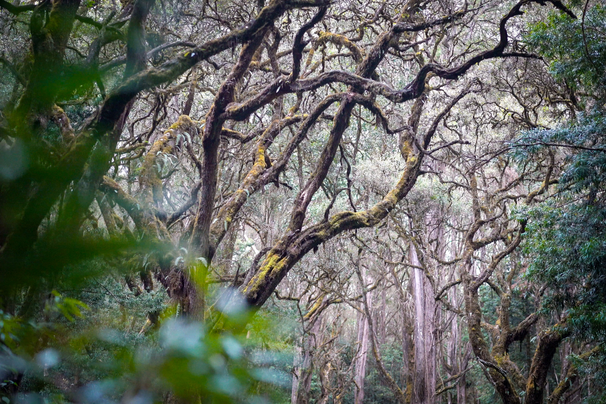
Thankfully, the elephant respected our hasty retreat and slowly turned back to his feast with friends. After we had sufficient distance between us and the herd, I let out a few hyena howls and reconnected with Paul and Martin. Nerves rattled, we pushed on with heightened caution, talking less and walking with care. However, as the landscape changed, so did our mood, and we strolled on with wonder at the magical forest emerging around us. The undergrowth thinned a bit, allowing us to stretch our legs and move faster. The canopy seemed to explode above in fractals of twisted branches—vines, and broad ferns draped over the gnarled arms. Colobus monkeys bounded around in the branches high above, their brilliant white tails like flashes of light under the dark green roof. It felt like a night and day comparison to the alpine terrain we had just left.
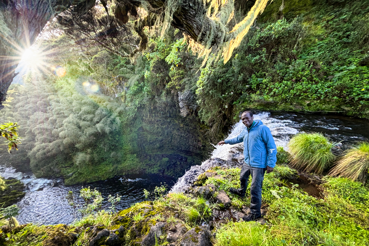
Rivers came to life around us, dancing their way down the escarpment on their long journey to the famous waterfalls in the southern sector of the park. Most of the large falls are marked on the map, but we began to come across smaller cascades that we had never heard of. Our route became a game of following the next roaring sound in the distance, and we came across some truly stunning natural displays. We were fully immersed in the forest at this point and had dropped below 10,000 feet. We stumbled upon the raging Gikururu River, and I knew we would soon hit one of the only roads crossing the park—a rough dirt track connecting multiple falls. Finally reaching it felt like a jolt of civilization. We collapsed onto the gravel, chucked our shoes off, and howled in excitement. This was a long-anticipated checkpoint, and meant we were making good time to cross the park in just over three days.
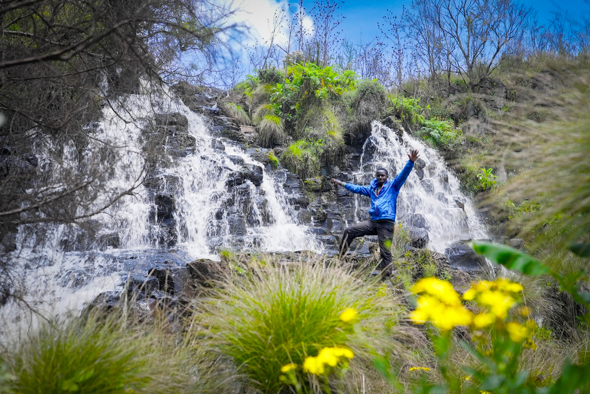
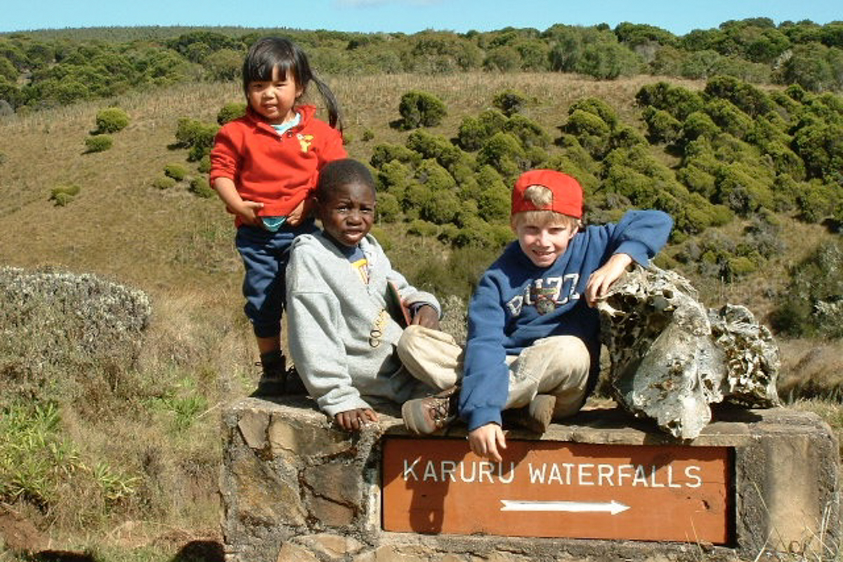
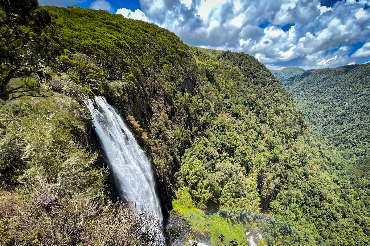
We walked the road for a few minutes until the turnoff to Chania, and were soon cooling off in the mist at the base of this impressive waterfall. It felt euphoric to finally make it to these zones I'd visited endless times as a young kid. Despite the distance we still had ahead, to have walked here from Shamata was a sweet victory in itself. After a brief respite, we filtered some water and slogged on, soon reaching the nearby Karuru Falls—a true testament to the majesty of the Aberdares. Plummeting a sheer 273 meters (896 feet) down over three distinct tiers into a massive sprawling valley, it is the tallest waterfall in Kenya, and leaves you in absolute awe. Mist swirls up from far below, painted by countless dancing rainbows. We hit Karuru just as the sun began to sink on the horizon, casting a dramatic beam of light onto other falls tumbling into the valley beyond. It was pure magic.

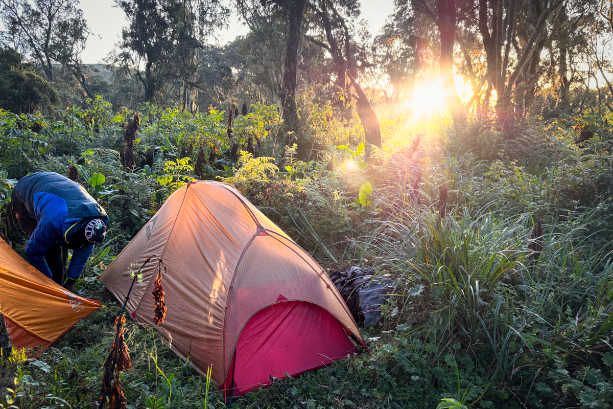
As darkness crept in we filtered enough water for dinner and began to climb up from the river into a paradise of low-lying hagenia and broad sweeping ferns. In the glow of sunset, it felt like a scene straight from Jurassic Park—and giant mounds of elephant and buffalo dung helped set the scene. We had clocked over 50 kilometers (31 mi.) of relentless bushwhacking at this point, and our bodies were starting to show it. Reaching these massive landmarks brought sweet relief, but our feet and hands were speckled with blisters, and our arms groaned from the constant thwacking away with machetes. That said, we were soundly on schedule and lined up to hopefully summit Kinangop the next day, where we would hit an established trail for the rest of the trek. Just as we found a flat spot about a kilometer from Karuru, dark clouds rolled in and thunder cracked overhead. We had just enough time to throw our tents up before the skies opened up and did what the Aberdares is known for best.
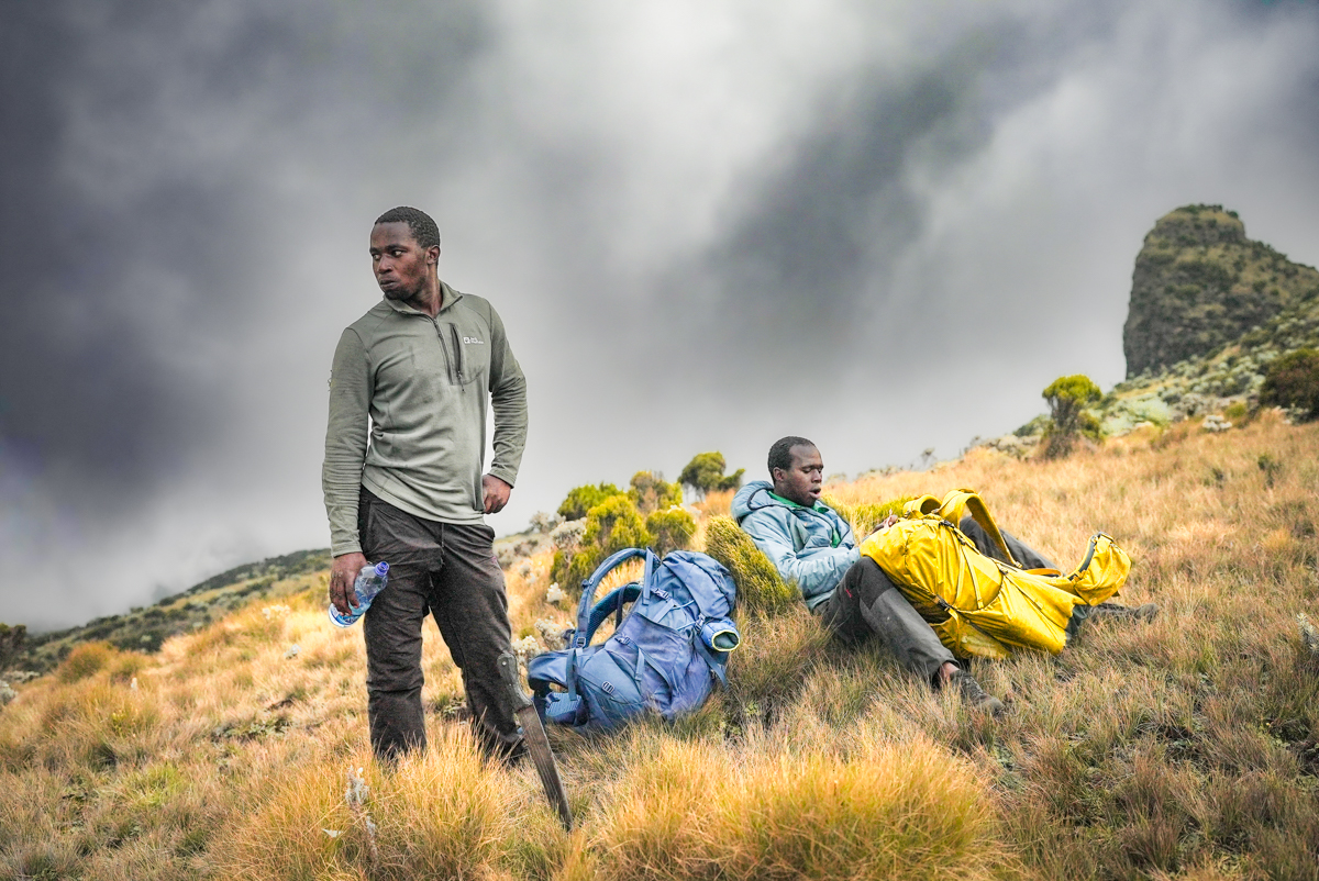
The rain was relentless, pouring for hours and extinguishing any hope of a fire for cooking. We crunched on cold dinners in our separate tents and tried our best to keep everything dry. Through the pounding rain, we began to hear large animals shuffling about—elephant, buffalo, or waterbuck, we couldn't tell. The cacophony of rain, thunder, and wildlife underscored just how small we were out here—how indifferent nature can be. Whether by sheer exhaustion or some other miracle, I soon fell asleep in the midst of the racket and woke to a brilliant sunrise thawing my soaked rain fly. Paul and Martin were already stirring, and I poked my head out into the damp, vibrant world around us. "I think I might be done," I heard Paul mumble. He was slumped down next to his tent, picking at a wet biscuit, and looked anything but stoked. "Everything hurts, and I just don't have the energy." In truth, we were all running on fumes, and morale was at an all-time low. It had been much harder than I anticipated getting to this point, and I could feel the conversation shifting toward bailing. But to be this close to Kinangop—the thought of quitting was brutal.
“We’re close enough to a road—you could bail here and call for a ride,” Martin said, “but I think you’d really regret not finishing.” The two of them are nearly inseparable, and if anyone could talk Paul into pushing on, it was Martin. “It’s tough, but reaching Kinangop is going to be incredible.” Hearing them weigh the decision so openly, fully engaged in the struggle and the reward of it all, was genuinely inspiring. And even more so when Paul finally hoisted his pack, took a deep breath, and started walking south—determined to see it through. This is the lifeblood of a backpacking trip. As the sun climbed, we skirted the lip of the huge Karuru gorge, slowly making our way to the Gura River. Another key checkpoint. Dropping down into a deep ravine, we heard the river far below—along with the deep roar of distant falls. Excitement mounted, and our aches and pains seemed to briefly melt away.

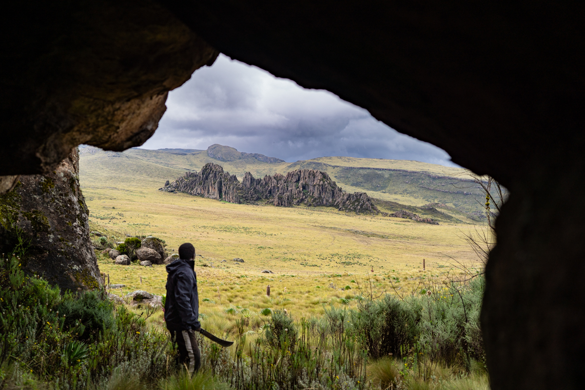
Hitting the river, we followed our ears downstream. Suddenly, we were at the edge of a large precipice—the Gura River dumping down nearly 18 meters (60 feet) into a gigantic bowl wreathed in dense bamboo and huge ferns flapping in the mist. We could stand right on the lip of the cliff and peer down. Truly a humbling scene. If there had been more time (and a rope or two), I would have loved to have explored the gorge further, but we had to keep pushing. Climbing up out of the steep ravine, we immediately met our next match: bamboo. The Aberdares is largely known for its vast swaths of bamboo thickets, which are equal parts beautiful, equal parts infuriating. Navigating bamboo is a heinous chore. Often the only paths through are highways carved by elephants... and walking along those is a gamble with death. We had been able to route around bamboo the entire way until now, but the wall of stalks before us seemed unavoidable. Brandishing our machetes, we begrudgingly charged into the fray.
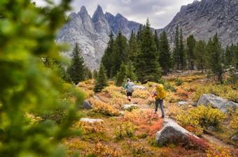
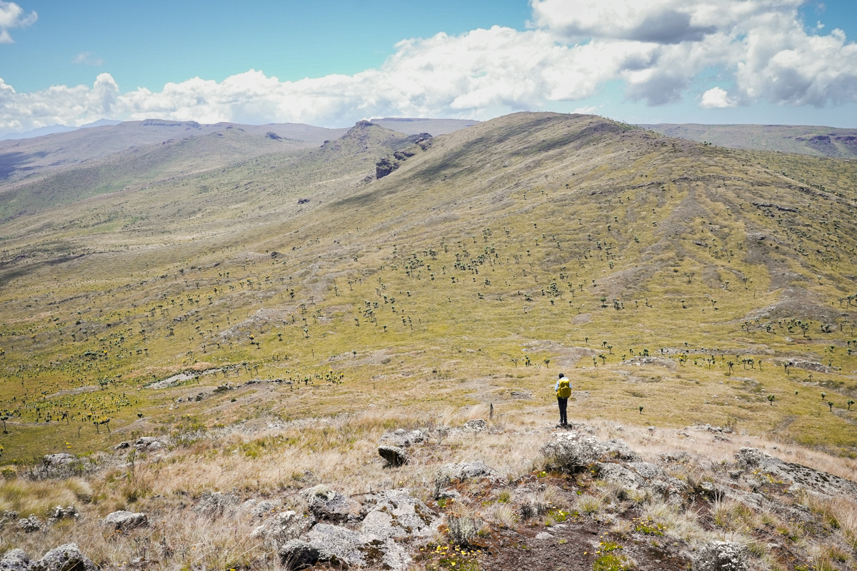
It felt like crawling through a giant game of pickup sticks. The bamboo was so densely packed it was tricky to get a proper machete swing in, so we spent most of the time shoving, ducking, and squirming our way through the thicket. Several times we stumbled across wide elephant highways—deeply trenched with hundreds of gaping footprints—and were sorely tempted to follow them. But the thought of confronting an elephant by surprise on their own path forced us to pick our own track. After a few hours of constant battle, we finally popped back into a thinning forest with minimal undergrowth and left the bamboo behind. A very welcome change. Suddenly, as if a veil was ripped away, we abruptly left the foliage and were trotting over exposed alpine moorland again. The diversity of the Aberdares truly gives it a unique beauty. Immediately the terrain began to steepen, and we eyed our long, grueling climb up to Mt. Kinangop at 12,815 feet. When I say this climb was one of the most difficult stretches of backpacking I've done, I mean it.
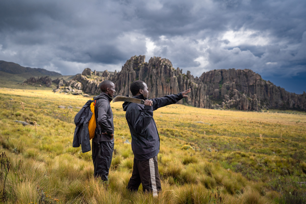
As we climbed higher, the brush thickened into an almost impenetrable wall, every step requiring double the effort. To make matters worse, dark storm cells were building fast to the east over the majestic 12 Apostles—a series of twelve dramatic, rocky peaks that decorate the southern sector of the park. "How much further?" Paul yelled through the wind. He had been giving it his all since our conversation this morning, but this climb threatened to be the last straw. He was hobbling, and clearly in pain. "The GPS says three more miles!" I shot back—but it seemed like it had been saying three miles for three hours. We slowly shoved on, seeming to lose progress rather than gain it. A herd of cape buffalo darted away from us, crashing loudly through the thick undergrowth and putting us even more on edge. Sweat poured down my shirt, and each move demanded mindfulness and intention. Finally... two more miles. After a particularly horrendous push up a steep slope, we popped onto an open, rocky viewpoint staring straight at the jaw-dropping 12 Apostles. We collapsed on the stone, chugged water, and burst into laughter at the madness of it all. This was brutal, but we were getting there.
Finally, after what seemed like an eternity, we crested Mt. Kinangop and scaled the final technical trail to its zenith. A thick wall of fog had rolled in ahead of the storm, swallowing us in a ghostly whiteout and denying us the iconic views I'd long dreamed of. I’d seen dozens of photos from this very spot—clear skies, sweeping vistas—but strangely, none of that mattered in the moment. We shouted in celebration, high on the accomplishment alone. Our sheer stoke despite the lack of views underscored the essence of a backpacking trip this challenging. It wasn’t about tagging the summit—it was about the sweat, the stories, and the shared suffering that got us there. And as if the mountain wanted the final word, the skies cracked open as we began our descent. Lightning struck nearby, rain came down in sheets, and we were hit by the fiercest storm I’ve ever weathered in the Aberdares. A fitting parting gift from this beautiful but inhospitable range.

From here we were able to hit an established trail that exited the park near Njabini. I had wanted to continue on to Elephant Hill on another ridgeline trail, but the sheer magnitude of the storm forced us to consider a lower route. Regardless, we had accomplished our primary goal: Find a route from Shamata down to Njabini. We hiked late into the night, everything completely drenched and our bodies aching in protest, but eventually popped through the park gate, entirely covered in mud. We looked more like warthogs than hikers. Thankfully, some Kenya Forest Service rangers opened up a back room in their station for us, and we collapsed on the floor next to their raging fire, totally spent. They offered us ugali and chai, and we regaled them with tales of our trek. The next morning, we signaled our friends at Cedar Retreat, who drove down to pick us up and bring us back up north. All told, our route came out to around 90 kilometers (56 mi.)—which was a bit less than I had anticipated—and entailed 19.8 kilometers (12.3 mi.) of travel on established KWS trails (the trail to Mt. Satima and the descent from Mount Kinangop).
Kenya isn't necessarily known for its hiking or backpacking, but there are some great opportunities for the adventurous traveler. Mount Kenya (Africa’s second-highest peak) is the obvious attraction for longer backpacking trips, though the main goal there is to summit one of its key peaks (Batian—17,057 feet, Nelion—17,021 feet, or Point Lenana—16,355 feet). There are very few opportunities for solely backpacking trips on established trails in Kenya, though the possibilities are expanding. There are, however, countless day hiking trails in the various parks around the country. Aberdare National Park offers one of the largest selections of day hikes in the country, with trails up Mt. Satima, Mt. Kinangop, Elephant Hill, The 12 Apostles, and short spur trails from the road to access Karuru, Chania, and Magura waterfalls (among others). For most long hikes, you must go with an armed KWS guard on any of the longer trails, as they know how to deal with animal encounters and serve as stellar guides. Be sure to consult with KWS rangers about your trekking plans at the gate to any park. As a reminder, the route we did is currently not an open trail, and you cannot trek in the Aberdare National Park without approval from KWS.
Aside from the Aberdares, there is extensive hiking in Hell's Gate N.P., Mt. Longonot N.P., Menengai Crater, Kakamega Forest, Karura Forest, Lake Elementaita, Ngong Hills, Kijabe Forest, and many others. Each of these areas highlights the unique diversity the country has to offer, and has various regulations for trekkers. Park entrance fees also vary depending on the area, and differ for Kenyan citizens, residents, and non-residents. Hell's Gate (one of the more accessible hiking areas), for example, currently enforces daily park fees of 300 KSH ($2.30 USD) for citizens and residents, and 3,367 KSH ($26 USD) for non-residents at the time of publishing. The Aberdares, on the other hand, has day rates of 430 KSH ($3.30 USD) for citizens and 6,734 KSH ($52 USD) for non-residents at the time of publishing. High park fees for non-residents are an ongoing conversation within the Kenyan tourism industry, and are constantly evolving. In the end, it's best to consult with your tour operator (or contact KWS if traveling alone) before visiting any national park to get details about travel and trekking requirements in different areas of the country.
Aberdare National Park lies roughly 200 kilometers (124 mi.) north of Jomo Kenyatta Airport in Nairobi—the most obvious hub to fly into—and is easily reached by following the A2 highway from Nairobi up through Thika to Nyeri. It’s also about 80 kilometers (50 mi.) from Naivasha. The majority of visitors arrive by road, typically with a tour operator. Once there, you have several options for staying at high-end lodges in the park, or camping if you're after a more rugged experience. If you'd like to focus on the northern sector—home to Dragon's Teeth, Mount Satima, Twin Peaks, and other unique attractions—Cedar Retreat is the only lodge in the northern part of the park. Down south, luxury lodges like The Ark (which overlooks one of the largest salt licks and waterholes in the Aberdares) and Treetops Lodge are stellar options.
Camping is allowed in the park at certain sites, but you must consult with KWS and book each site prior to your trip. Some sites, such as Reedbuck Camp, have basic amenities such as showers and toilets. The best place to fuel up on supplies before visiting the park would be Nairobi, Thika, or Nyeri. Hiking, camping, and backpacking gear can be purchased from Decathlon in Nairobi, which carries an impressive selection of quality outdoor gear, or Going Outdoor in Two Rivers Mall and Galleria in Nairobi. One issue I always have when backpacking in Kenya is finding appropriate stove fuel since you can't fly with stove canisters from Europe or the United States. You'll rarely see isobutane-propane (IsoPro) canisters in Nairobi, which are used on most popular backpacking stoves, like the MSR Pocket Rocket—my personal pick. I'll sometimes find piercable butane/propane cartridges at Going Outdoor or Decathlon like this one, but it's rare to find canisters with screwable self-sealing valves. You can usually purchase stoves compatible with this type of fuel in-store if need be (like this one). In light of this, we decided to cook over an open fire on our trek, which proved troublesome in the rain.
Masai Mara National Reserve (also spelled "Maasai Mara") is hands down the most popular safari destination in Kenya, offering peerless game viewing of the Big Five (lions, elephants, rhinos, cape buffalo, and leopards) and countless other animals in an absolutely stunning setting. There is very little trekking offered in Masai Mara due to the inherent danger from wildlife, and most activities are limited to 4x4 safari vehicles (or hot air balloons for those seeking a unique perspective of the savanna). The day rates to enter the Mara are significantly steeper than other parks at a whopping 25,900 KSH ($200 USD) for non-residents from July to December (high season) and 12,950 KSH ($100 USD) from January to June (low season) at the time of publishing. It's also 4,500 KSH ($35 USD) for residents and 3,000 KSH ($23 USD) for Kenyan citizens year-round at the time of publishing. These high rates can be a deterrent for many, but underline the growing demand for access to the reserve’s incredible natural beauty and wildlife. Aside from the Mara, Tsavo East and West National Parks are popular safari destinations, along with Lake Nakuru National Park, Samburu National Reserve, the high plains of Laikipia, and several others.
Tourism in Kenya is largely structured around the rainy and dry seasons, which means different things depending on the area you hope to visit. Kenya experiences two distinct rainy seasons: The heavier rains typically occur from mid-March through May, while a shorter rainy period falls in November and December. January and February are generally dry, though occasional showers are still possible. The main dry season, marked by cooler temperatures, stretches from May to October. I have visited East Africa at all times of the year (and lived near Nairobi for most of my childhood) and have found pros and cons to each season. Many tour operators recommend visiting Kenya between June and October when rainfall is minimal and daytime temperatures are pleasantly mild. However, this high season also draws the largest crowds. Traveling outside of this window can still offer an incredible experience, with fewer tourists around. Ultimately, the best time to visit depends on your destination and the type of adventure you're after. Whether it's the humid coastline of Mombasa, the iconic plains of Masai Mara, or the cool highlands of Mount Kenya and the Aberdares, Kenya’s diverse landscapes offer something remarkable year-round.
The Aberdare Range can get extremely cold year-round—even in the dry season, it can still rain a good deal. This is the coldest time of year, with afternoon temperatures around 15°C/59°F. Nighttime and early mornings are cold, at just a few degrees above freezing. Warm waterproof clothing and solid weatherproof camping gear are necessities if overnighting in the park.
Editor's note: I was shooting a documentary film of this trip, so I brought a lot of bulky gear for filmmaking. For more manageable options for trekking, check out our list of the best cameras for hiking and backpacking.