
Photo Credit
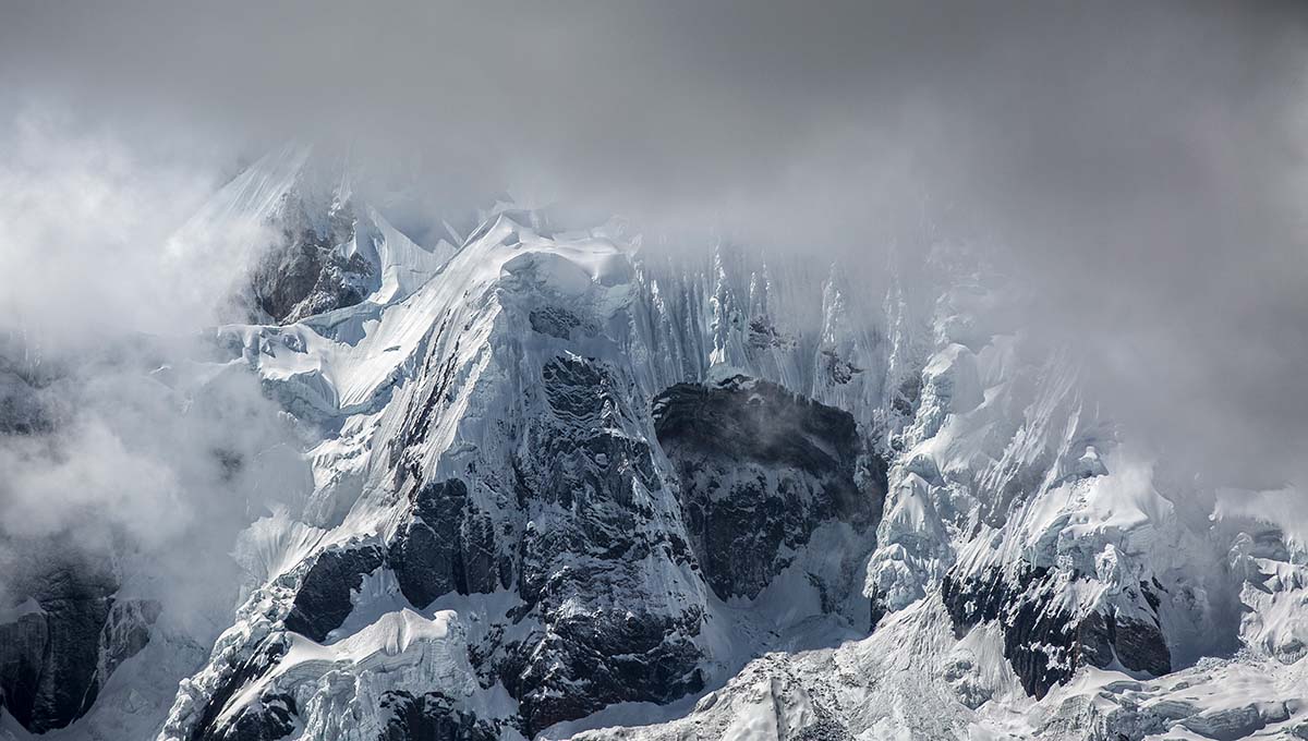
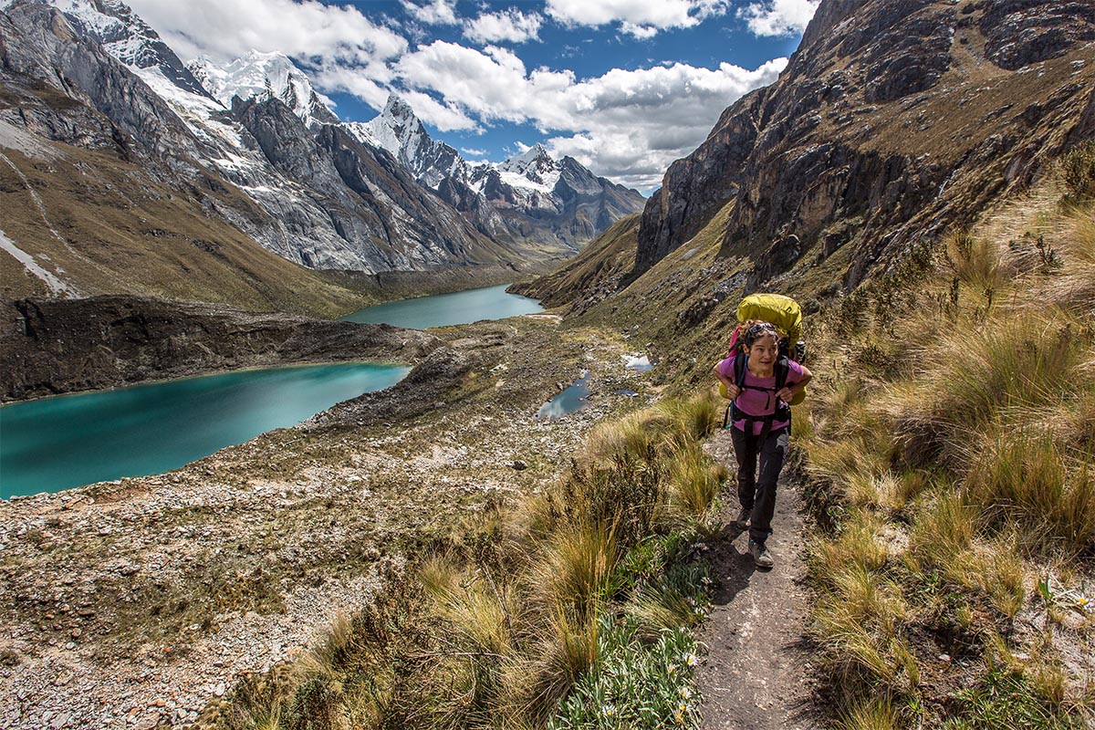
From our campsite, the green valley rises, steepens, and becomes rocky and cold. Eventually it turns to glacier and then vast, snow-blanketed mountain. I pull the hood of my down jacket tight to my face. The cool, thin air and the enormity of my surroundings rousing me better than the darkest cup of coffee. Around a small ridgeline and between two small knolls, I glimpse our day’s objective, and squint my eyes to pick out the trail winding through the green and scree up to the pass. The scale of this landscape silences me and I wipe chilling tears from my cheeks, feeling immensely grateful for another day in the Cordillera Huayhuash.
Peru is most known by tourists for ancient Machu Picchu and many cultured cities rich in archaeology and history, but it’s also home to some of the tallest and most remote mountains in South America. Of the trekkers who visit Peru, most head straight to the Cordillera Blanca just north of Huaraz, enticed by the high concentration of peaks exceeding 6,000 meters (around 20,000 feet). However, the Cordillera Huayhuash (pronounced “why-wash”)—just 19 miles long, 9 miles wide, and only boasting three summits over 6,100 meters—caught our attention. With the Huayhuash’s less touristy vibe and miles of trekking potential, we made the decision to stray south of Huaraz and slightly off the beaten path. And we are thrilled that we did: after biking through the Cordillera Blanca and hiking in the Cordillera Huayhuash, the Huayhuash stands out as one of the most memorable adventures we’ve ever experienced.
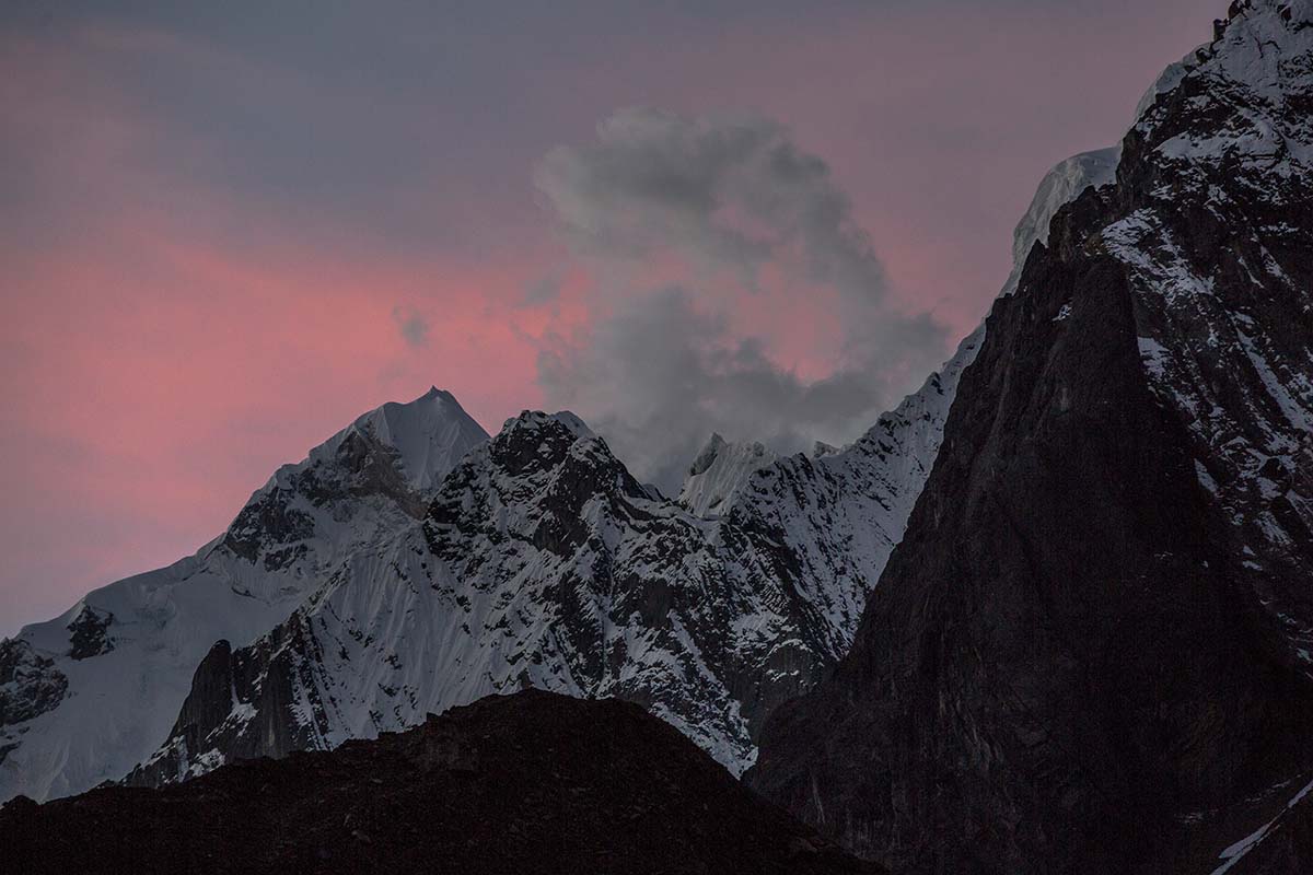
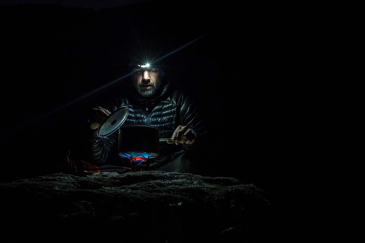
The first couple of days in the Cordillera Huayhuash provide a taste of what is soon to come in abundance. As we hike deeper into the range, the mountains grow and begin to envelop us, making us feel remarkably small and remote. Locals often comment about the size of our backpacks and lack of donkey accompaniment. And becoming more accustomed to the omnipresent manure on the trail, we realize that this is a thoroughfare more for animals than us (as if to prove the point, we are accompanied throughout our hike by various feral dogs). Settling into our camp routine at night, the vividness of the Milky Way glimmers down at us, and we escape the cold by tucking into the tent and falling asleep at sunset. 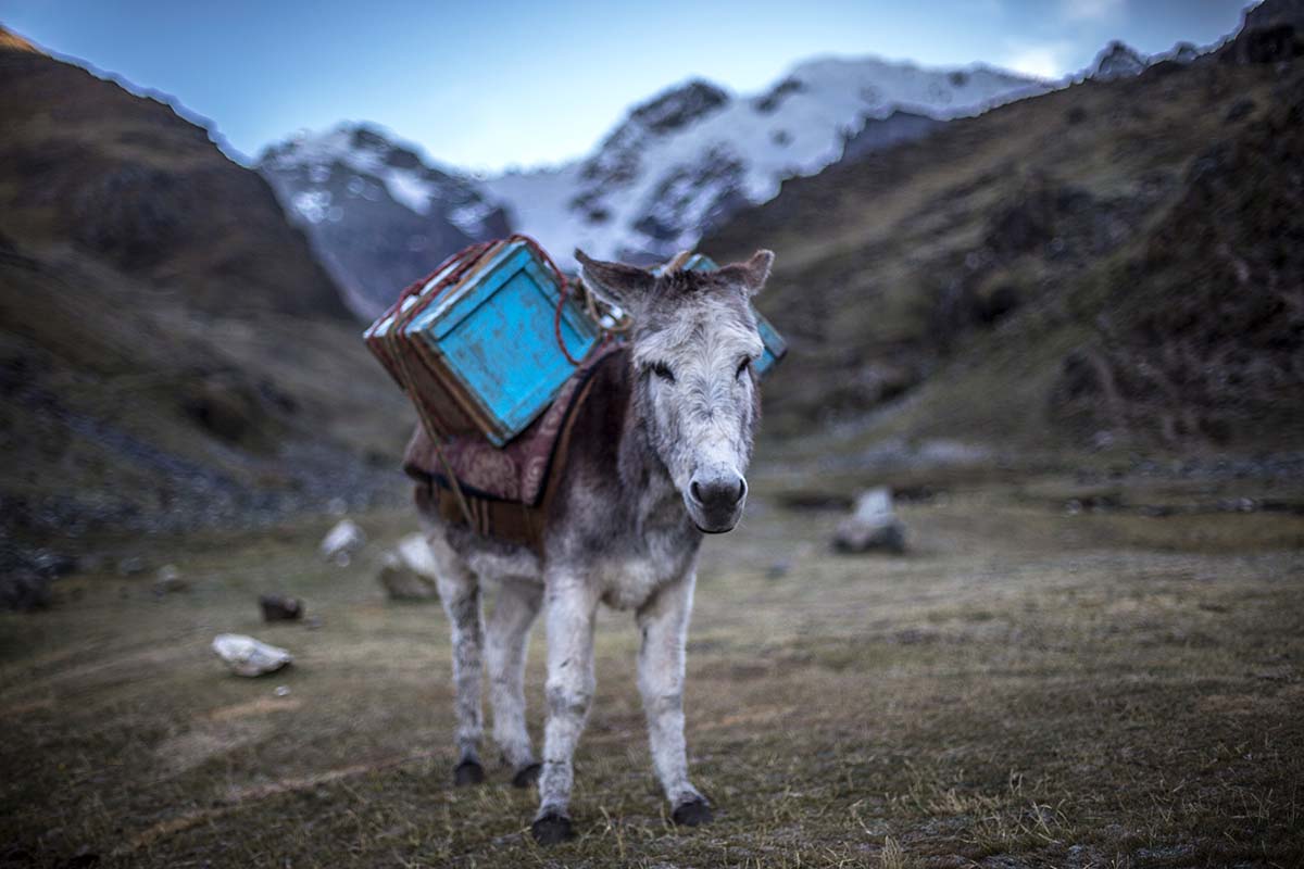
The route on our third day is a stunner. The morning begins at a campsite along the vibrant Laguna Carhuacocha, overshadowed by the dramatic peaks of Suila Grande, Yerupajá, and Jirishanca. These mountains, which dominate the Cordillera Huayhuash, accompany us for the day. Along the way, surreal turquoise lakes (Lagunas Suila and Quesillococha) also come and go from our side. A steep trail brings us to a classic mirador (viewpoint) and ultimately to Suila Punta (punta means mountain pass).
I expected the day to be beautiful, but never imagined this sort of splendor. We were rendered speechless. No mountains we have ever seen—which is a lot—could have prepared us for the powerful and extraordinary beauty of the Huayhuash’s largest peaks. And for the first time I can recall, Brian struggles to fit the dominating peaks into his camera’s viewfinder, even with his 16mm wide-angle lens. 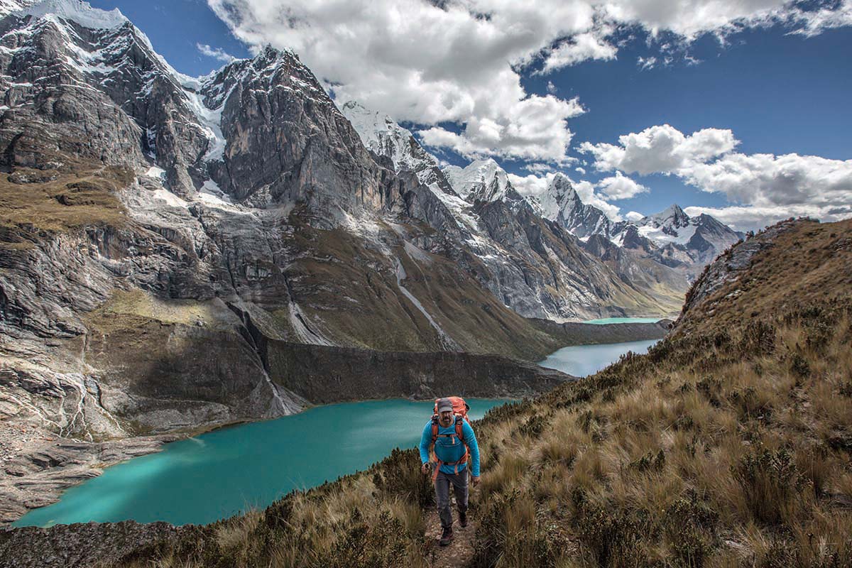
This morning, we opt for the lesser-traveled route over Trapecio Punta, which means we’ll miss the hot springs (and perhaps a needed bath) in Viconga. When views are better than hot springs, that’s saying something. This is the first decision that takes us off the typical circuit, and although making for a longer and more effortful day, the panoramas are indeed unique and among the most magnificent of the entire trek (this route is not detailed on the Alpenvereinskarte map, but is outlined in Peru’s Cordillera Blanca and Huayhuash: The Hiking and Biking Guide as an “alternative route”).
We feel like we’re hunting for treasure as we follow the guidebook’s cryptic descriptions, looking for landmarks such as the “red earthy scar.” Thankfully there are a few cairns where the route first detours from the main trekking trail, and though we end up climbing more than necessary before reconnecting with the correct path, we realize that as long as we’re able to identify the pass (“where light and dark rock meet” to the left of the impressive Nevado Trapecio) we cannot go wrong…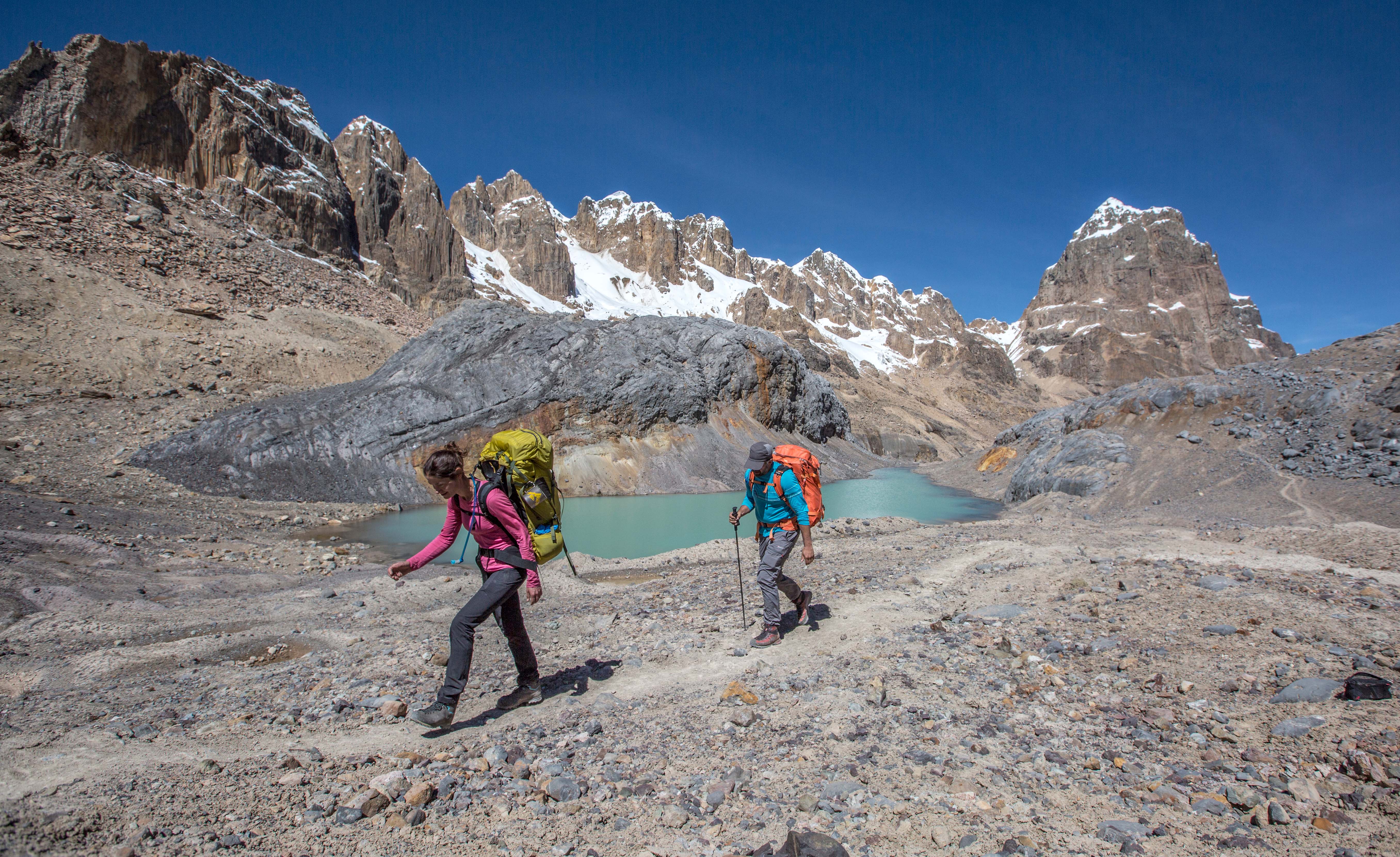
Though Day 3 was incredible, we decide that Day 4 is our new favorite. Cuyoc Camp feels as though we’ve been transported to another planet: the earth is red and barren, and dotted with brilliant turquoise lakes. Mars, perhaps, or Moab? No, this is the Cordillera Huayhuash, and it comes with its own set of surprises: While Brian is up taking photos of the incredible Milky Way, beautiful and healthy foxes dart by our tent. We later learn that they have been known to steal boots, so we start taking ours into the tent with us each night.
Day 5 is equally stunning, and soon becomes our new favorite (you might sense a little pattern here). We opt to go over Paso Santa Rosa (called Paso Jurau in Peru’s Cordillera Blanca and Huayhuash) to Cutatambo. Most groups follow the mule path and go directly to the town of Huayllapa or onto camp at Huatiaq, thereby bypassing what we consider to be the most spectacular pass and scenery of the circuit. 
Running parallel to Paso San Antonio (labeled on the Alpenvereinskarte map), Santa Rosa offers equally impressive views as its neighbor, and a more moderate—though still steep—descent. The route is easy to navigate if you start by going back the way you came from Nevado Trapecio, then turning left on a trail to head up. The last section leading up to the 5,060-meter pass is a gruelling climb through steep snow, but every step is worth it. The views from the pass are stupefying—the Huayhuash’s tallest peak, Yerpaja, dominates the skyline, with Suila Grande in the background and turquoise Laguna Juraucocha in the valley below.
We spend close to two hours enjoying the scenery, noting that we are becoming comfortable at altitude while sipping a cup of tea and trying to figure out the route that Joe Simpson and Simon Yates climbed on their notorious Touching the Void mission. The breath-taking valley from which Joe limped remains in view for much of the descent and, like many of the scenes we’ve encountered, includes dazzling lakes and impressive glaciers. At Cutatambo Camp, we are thrilled to see a condor circling high above, the largest bird either of us has ever witnessed. 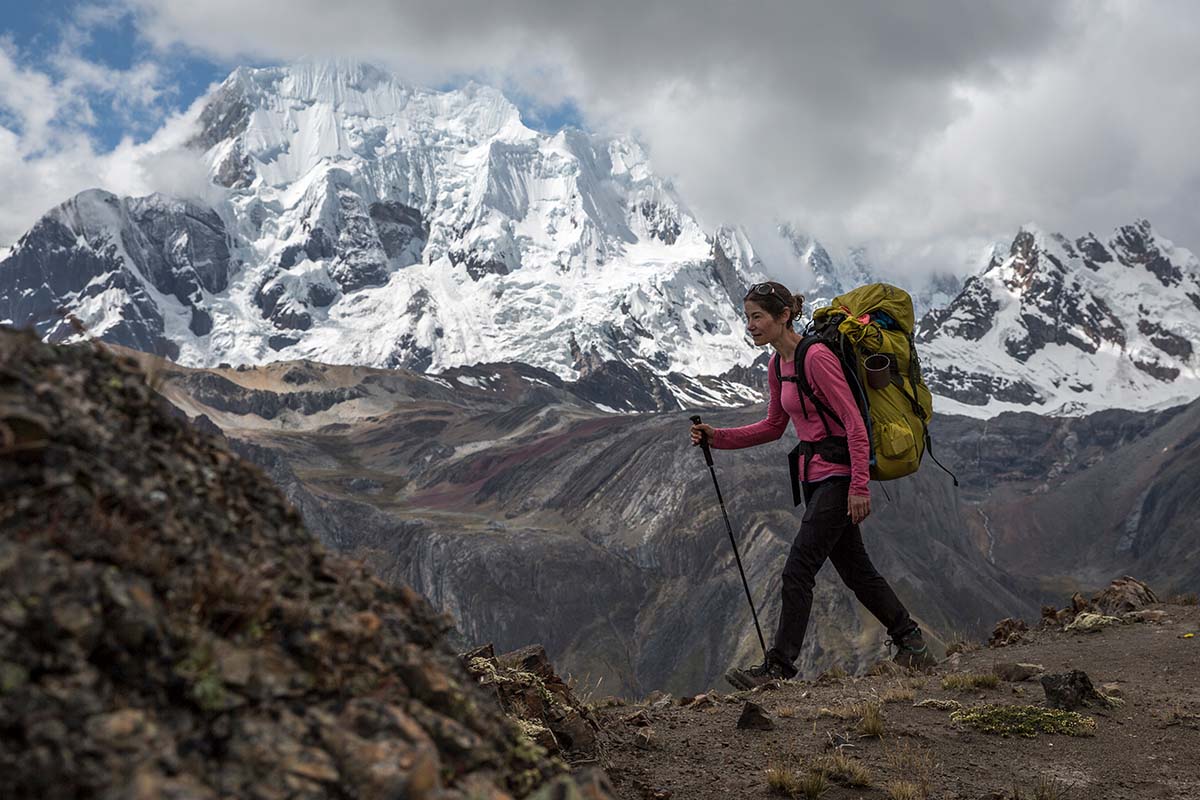
We read and heard first hand that the descent from San Antonio to Cutatambo was loose and dangerous, informing our choice to take the high route over Paso Santa Rosa instead of this technical one next door. Having said that, we watched from afar as an adventurous feral dog ventured up and over Paso San Antonio, and greeted him as he arrived limping in camp that night. The next day, this intrepid dog, which by then had been named “Marley,” was handed off to a campesino who was looking for a small pet.
Day 6 brings us down to Huayllapa, and below 4,000 meters (~13,000 feet) for the first and only time on the trek. This is also our only opportunity to resupply, and we pick up a seemingly lifetime supply of baby wipes (no small packages are available in the small store), enjoy some overly sweet Gatorade, and start the hot and relentless climb out of town to a camp at Hutiaq. We opt for the quiet lower camp, which does not have room for groups. 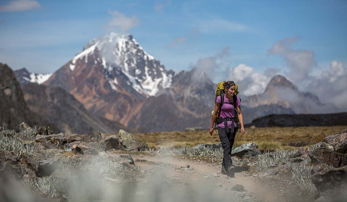
Day 7 is lovely and relatively short, and we enjoy a relaxed morning before setting out. Many trekkers hike over two passes in this day, which we considered, but instead decided to call it a day after the first pass Tapush Punta, and camp in Gashpapampa—a minimalist camp with pit toilets. This sets us up for a full day enjoying Yaucha Punta and an alternate route with exceptional miradores on Day 8. Were we to push on and complete both passes in a day, we’d simply have an extra day in Huaraz or Lima. Let’s be honest: we’d rather spend the time in the Huayhuash.
Our more relaxed itinerary and alternate route provide us with off-the-beaten-path miradores, and Day 8 becomes our new favorite day. From Yaucha Punta, there is an option to diverge from the main trekking trail, following a ridgeline to the left. Most trekkers who combine this day with the pass of our previous day—even those with donkeys carrying their load—are exhausted by this point and typically opt for the more direct trail down the valley. However, the panoramas from this ridge are among the best we see on the entire hike, and provide a unique perspective of Huayhuash’s giants, including Yerupajá and Jirishanca. Perhaps because we are so high above the green valley and granite cliffs, the glaciated peaks rising behind them seem even larger than they had previously. The Cordillera Blanca is visible in the north, with colorful layers of mountains to the west.
The views do come at a price however: The 2,300-meter descent from the ridge is a precipitous, toe-numbing and knee-breaking slope, with loose dirt held in place by the roots of brilliant lupine bushes. All in all, it is arguably the most difficult section of the entire circuit. I curse my heavy load and laud the traction of my boots, which keep me from slipping time after time. 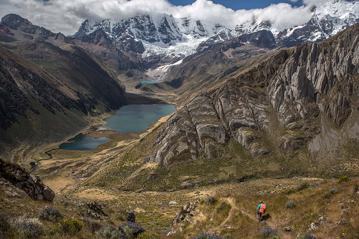
The picturesque camp at Laguna Juhacocha is the busiest we encounter. Close to the town of Llamac, it is used as an entry and exit point for the traditional circuit as well as shorter versions of the trek. The proximity of this camp to town has one advantage, however: a campesino carries in cerveza and terribly sweet Peruvian wine regularly, both of which are sold for a reasonable price. We celebrate our successful trek over beers with friends we’ve made along the way—two Swiss hikers, a Swede, and a Dutch/South African couple. Our rag tag group discusses international politics for the first time in weeks as a feral dog munches on a recently-severed cow head close by. The Huayhuash has truly removed us from the day-to-day concerns of the world, and this contrast of wild and civilized is not lost on us.
We crawl out of our tent in the cold and darkness of 4:30am to start our hike out by 5. There are rumours of full buses and we want to be sure we will catch the 11am bus in Llamac that will take us to Huaraz. We enjoy the sunrise from the trail and slowly make our way out of the mountains and back to reality. This day is no cakewalk—it has decent climbs and another long descent. We finish the hike filthy and smelly, and I particularly am dishevelled, my front tooth missing (I lost a crown earlier in the trip) and hair that has tied itself into one single knot. If that’s the asking price for nine of the most exceptional days of my life, I’ll take it.
With 20 days in Peru, we planned to spend 5 days cycling and 10 days trekking, with a few days slated for rest and travel in between. We decided to cycle in the Cordillera Blanca, circumnavigating its largest peak, Huascaran (see On Location: Cordillera Blanca), before heading out on our trek through the less-visited Cordillera Huayhuash. Biking in the Cordillera Blanca prior to our trek allowed us to acclimatize in slightly lower altitudes before subjecting our bodies to hiking on technical terrain at over 5,000 meters with heavy loads.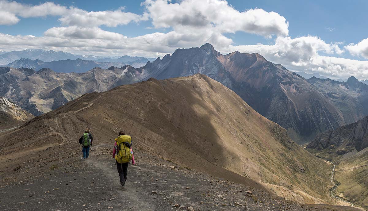
Our trek ended up lasting nine days (we have a habit of planning for more time than we need), and the itinerary we chose was perfect. We are thrilled with our route decisions, believing that we took in the most spectacular vistas the Huayhuash provides. Below we outline the logistics, the route we travelled, the gear we brought, as well as a few other things you might find helpful.
There are numerous considerations when pondering a trek in the Cordillera Huayhuash. Will you choose a guided trek, or perhaps simply opt for support (by porter/pack animal)? If so, will you go through an agency or independently arrange your guides/support upon arrival? Will you travel with a group?
All are very viable options. Agencies in Huaraz line the street offering various levels of guiding or support, and a quick search in your internet browser will reveal the same. Agencies typically include transportation to and from the trek, a guide, all meals, and donkeys/horses. Guides can also be hired without an agency, as can arrieros, or donkey handlers. In these cases, trekkers are responsible for feeding and providing shelter for their guide and/or arrieros.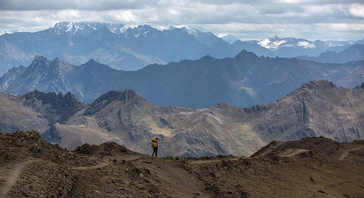
Once we researched and were confident that our personal safety was not a concern, and that we would be able to follow the route with our topographical map and guidebook, we settled on trekking the circuit independently without support. This meant that we would have to carry ten days of food and fuel along with Brian’s heavy camera gear for over 70 miles. It also meant that we had the flexibility to alter our route as we went, and ultimately this was the best decision we made. Having said that, I suspect that trekking the Huayhuash with support can have its own perks and would be a great decision for many. Either way, you’re bound to have a mind-blowing experience, with or without 50-pound backpacks.
Thus, for those wondering if going self-supported is a viable option, it absolutely is. Make sure to allow enough time to be fully acclimatized before you start the circuit (there are not many options for rapidly descending to lower ground if symptoms of altitude sickness appear) and that you are comfortable carrying enough food for 10-ish days. The distances each day are relatively modest (6 to 12 miles), but the elevation gain and high altitude certainly up the difficulty quotient. We typically spent anywhere from four to eight hours on the trail each day, which included numerous stops to take in the scenery, rest, and refuel.
To reach the Huayhuash, many independent trekkers take a bus to Chiquián and then to Pocpa, and hike about two hours along a mining road to begin the trek in Matacancha (also called Quartelhuain). We decided to save ourselves a day, and instead travel to Matacancha by hiring a taxi from Huaraz. At the time of publication, private transportation costs 370 to 400 soles as opposed to the 25 soles the bus would have cost, but our taxi journey took less than three hours (thanks to our driver, Fredi, whom we dubbed “Fast Fredi”), whereas bus travel takes six.
We budgeted ten days to complete the hike, unsure of how long it would take with our heavy packs and the high altitude. Ultimately, the trek took us nine days, and Brian and I feel that were we to do it again, we would make all of the same route-finding decisions. Our itinerary is based on the one suggested by the guidebook Peru’s Cordillera Blanca & Huayhuash: The Hiking and Biking Guide, with some variations.
If you have a map and follow along, it’s much easier to make sense of names:
Of the nine days, Brian and I agree that four days stood out as offering the best views we have ever seen (Days 3, 4, 5, and 8). Days 1, 2, and 7 still were stunning and otherworldly, but not quite as dramatic. Days 6 and 9 definitely were beautiful, but felt more like necessary “travel” days.
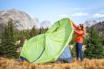
During the trek, we camped in our MSR Access 3 tent at designated spots along the trail. There is a fee system in place for passing through the various communities on the Huayhuash, typically collected at camp spots. We were happy to pay it: we felt as though we were supporting the local communities, and have heard that the system has contributed to trekker safety as well. The communities provide some trail and campsite maintenance, though the quality and cleanliness of the toilets varied considerably. In total, the cost of our 2017 trek was 205 soles (less than $70) per person for the entire circuit, broken up between nine communities (this number might be slightly more or less if you take alternate routes). 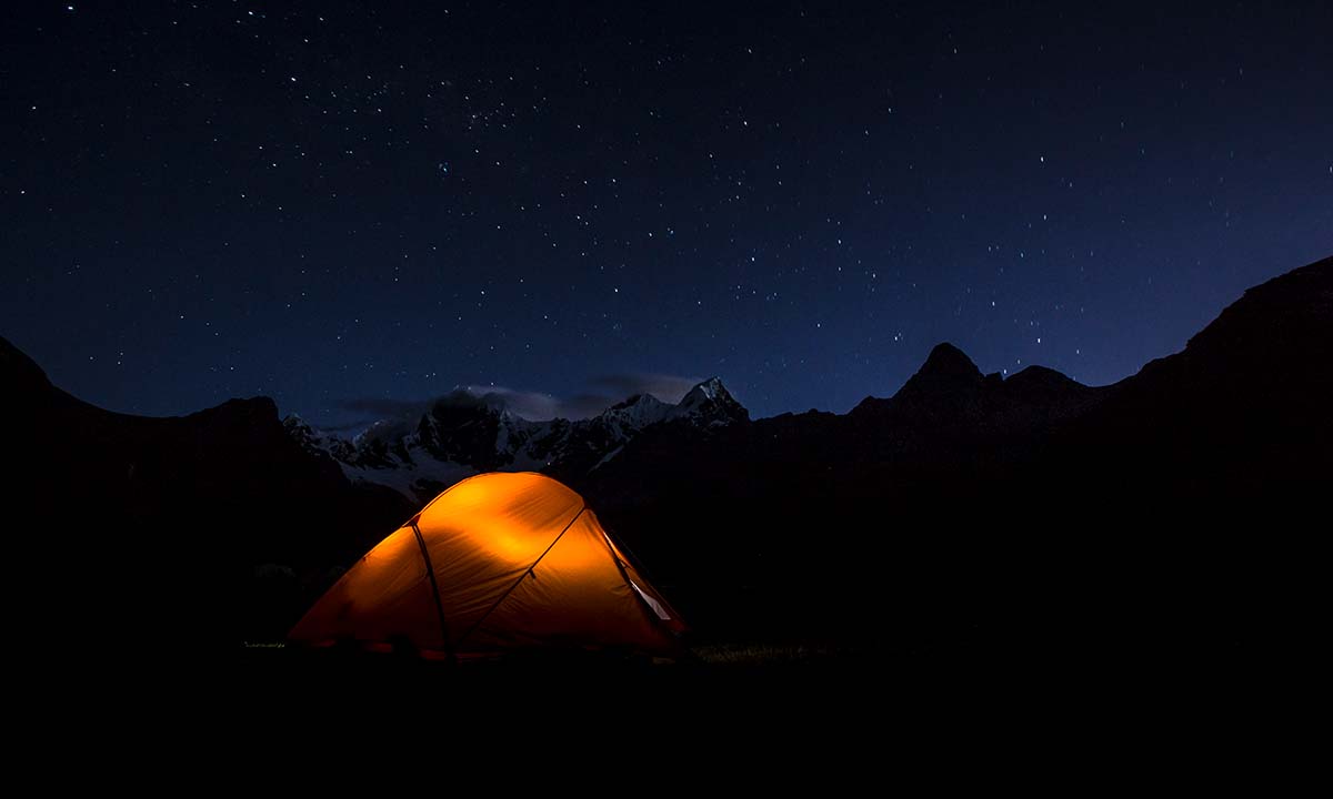
Before our trek we stayed at Olaza’s in Huaraz, and cannot say enough good things about this guesthouse. We were able to store our bikes and extra bags here while we trekked, and the staff was eager to help us book any taxis we needed. We planned to stay at Olaza’s upon our return, but we were a day earlier than anticipated, had no reservation, and the guesthouse was full. We were crestfallen (and filthy and exhausted), but the manager Rosa was quick to suggest an alternative guesthouse (which thankfully worked out), and Olaza’s cancelled our reservation for the following night and kept watch over our bikes free of charge.
Weather can be extremely variable at such a high altitude, with wind, fast moving rain showers, and blazing sun. The temperatures range from the mid-80s during the day to well below freezing (as low as 15°F) once the sun goes behind the mountains.
Guidebook: We relied heavily on Peru’s Cordilleras Blanca and Huayhuash: The Hiking and Biking Guide by Neil and Harriet Pike. Prior to our trek, I cut out the relevant pages (as much as it pains me to deface a book), and taped them together to lighten our load. This guidebook is not readily available in Peru, so we recommend purchasing it prior to leaving home.
Map: We had Alpenvereinskarte’s Cordillera Huayhuash map, which is the best topographic map of the area. The map is available at many stores and trekking company offices in Huaraz. In addition, there are numerous phone apps with maps and routes, but we did not want to rely on our phone (and I personally love the context and perspective provided by “real” paper maps). 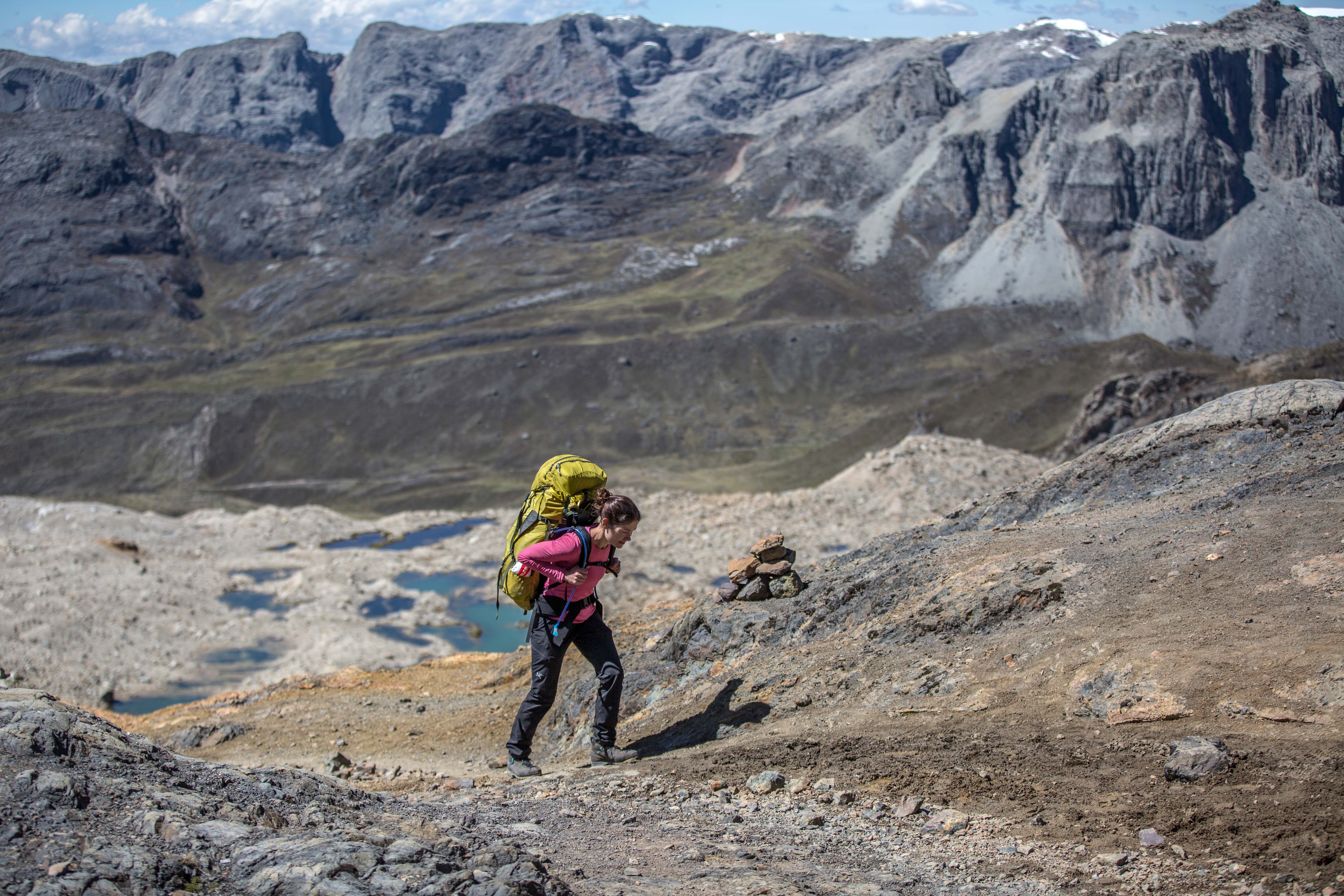
Infamous for its starring role in the book and movie Touching the Void, every photo we saw of the Huayhuash was spectacular: glaciers hanging onto near vertical summits with massive relief between valley and peak. Interspersed with the beautiful photos, however, were murmurs of banditos and armed robberies that had us questioning whether we’d be safe trekking in the Huayhuash. Further research revealed that the region has indeed been riddled with crime for a period of time. However, the Huayhuash is now widely considered safe for tourists, including those travelling unescorted by a guide or agency. In fact, the locals support tourism, and the many communities along the trail benefit from the money trekkers pay for camping and trail use fees. In the end, we never felt even a hint of concern for our safety while travelling in Peru.