Marty Schnure spent the austral summer of 2013 exploring and mapping the vast terrain of the new Patagonia National Park as a National Geographic Young Explorer. The Park officially opened in October 2014, and you can see Marty’s work at Maps for Good including both online and print versions.
Please give us a little a background on yourself and the project.
Mapping the future Patagonia National Park is the flagship project of Maps for Good, our place-based visual storytelling team based in San Francisco. Fresh out of college, my partner Ross Donihue and I were cartographers at National Geographic when we saw an unmet need out there: better-world initiatives need fresh, beautiful visuals to stand out from the crowd, tell their story, and engage their audience. So we left our jobs and founded Maps for Good with the mission of creating maps that visualize and empower the work of social and environmental initiatives. Our first assignment was our big dream: fly to the bottom of the Earth on a shoestring budget and spend three months living in a tent mapping the future Patagonia National Park in Chile.
We're grateful to have received a National Geographic Young Explorers Grant, contributions from 210 supporters on Kickstarter, and equipment sponsorships to fund the project. Now, a year later, we've published the first map and guide to the future park and have launched an interactive map to allow individuals around the world to explore the park on the web. You can check it out at mapsforgood.org/patagonia.
Can you give some insights on the mapping process? How long were you out in the field?
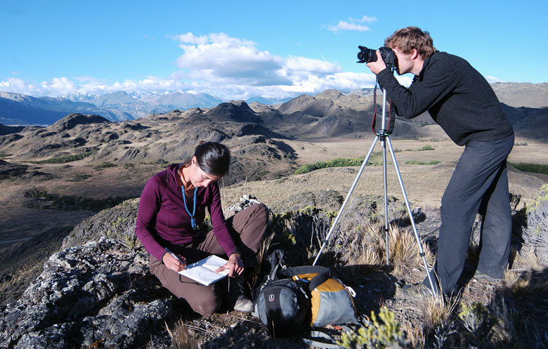
We were in the field for three months, January through March. We were there at the height of the austral summer and through early autumn. Since so little geographic data exists for the ultra-remote region of Aysen, we were collecting data on the ground with a GPS and ground-truthing the data we were able gather from other sources. We were there to explore the place as much as we could and get to know the landscape so that we could in turn create maps that connect people to the place. We set up a base camp in the campground and took trips of up to six days into the backcountry at a time. A big goal of our project was collecting beautiful imagery and capturing the soundscape of the park with audio recordings. For example, for the interactive map, we created immersive, 360-degree panoramas that allow users to get on the ground, so to speak, and see the view. Part of our work was also creating a geographic database to hand over to park administrators to help them with planning and development into the future.
What are your impressions of Patagonia National Park?
It's beautiful. To get there from the nearest airport, you have to drive down the Carretera Austral, or the Southern Highway. A drive that takes locals five hours took us two and a half days; we were stopping so often to take pictures, explore side roads, and take it all in.
The park itself is an amazing example of what can happen when a group of ambitious philanthropists, conservationists, scientists, and workers work together on conservation. It's stunningly beautiful and surprisingly diverse. The Chacabuco Valley is a rare east-west valley in the region, connecting two climates that we usually separated by the spine of the Andes. It's a place where the arid Argentine steppe meets the wetter Chilean forests, creating a diversity of habitats in close proximity to one another. That's part of why this particular area is so ecologically critical.
What are one or two of the most memorable experiences that happened along the way?
Prior to our time in the field, neither Ross nor I had ever been in a place so remote that we could go backpacking for six days at a time without seeing another human or even hearing planes flying overhead. We had also never been to a place where we could drink directly from the rivers and streams. There's so little human impact in the area that there's no need to filter or treat drinking water. It was ice cold and delicious. When you're out there you really feel that you are on the leading edge of conservation.
Right at the western boundary of the park is the confluence of the Baker and Chacabuco rivers, a beautiful spot that was, until recently, one of the sites for the highly controversial planned hydroelectric project, Hidro Aysen. On brutally hot days, we would spend the afternoon down at the confluence, enjoying the cold water and the breeze. It was heartbreaking to know that it wasn't going to last. Needless to say, we're all thrilled that the dam project has been declared 'dead.'